

Scialet du Combeau was Speleo Vercors Summer Project 2007/2008. The CNCC
Technical Group and the BCA Equipment Committee had wanted to install an ECO
Anchor test bed where the day and night temperatures exceeded those found in the UK.
We had unexpectedly stumbled across the entrance to Combeau and decided that not
only was it a good place for the test bed, the 80m deep shaft would also be a good place
to install an ECO Anchor SRT route.
Scialet du Combeau Location:
Map: IGN TOP 25 3236 OT Villard-de-Lans
IGN: 847,66 X 292,87 X 1490
GPS: 31N 695222E 4974073 Alt: 1490m
Scialet du Combeau is located on the high plateau of the Vercors National Park in south
east France. Follow the D518 south from La Chapelle-en-Vercors, past St-Agnan taking
the second left turn after passing the show cave of Grotte de la Luire – this is the Route
Forestiere de la Coche and leads to the parking area for walking to the Grand Veymont.
Continue past the parking area and the old forest refuge and take the next left turn, the
Route Forestiere de la Charbonnieres. Follow this road for a couple of kilometres to just
before the spot height of 1517 shown on the map, at the point where a path joins the
road from the north (left). There is just about enough room here for one car to park off
the road. There is further parking a few metres further along the road.
Scialet du Combeau is located to the south west of where the path joins the road. The
cave entrance can be seen by descending to the obvious limestone bench to the south
of the road.
Scialet du Combeau: Rigging Guide
Care: Beware of falling rocks – everything that falls from the surface goes rapidly
to the bottom of the shaft. Try to avoid descending Stupot until all the party are in
the chamber at the top of the big pitch. There is no where safe to unclip from the
rope!
The entrance pitch is rigged from an initial anchor located in bedrock above and to the
right of the shaft. It is important to use this anchor as it provides security when descending
the grassy bank to rig further anchors. There is an obvious large boulder that can also be
used with a sling to provide an optional Y hang from the second anchor. A short descent
leads to the third anchor, which is located over the open shaft. (There is a rub point below
this anchor and suitable protection should be used to prevent damage to the rope). A
further short descent leads to a re-belay from where a good ledge can be reached to rig
the final anchor, which provides a 10m free hang to the top of a steeply descending,
greasy gully.
A low anchor provides security for descent of the gully (5m) to an anchor at the top of
the 6m pitch. From the bottom of the pitch, an anchor on the south wall is the start of a
steeply sloping descent into a very steep (and loose floored) passage. Just inside the
passage, high on the right (as you abseil) is a further anchor. The steeply descending
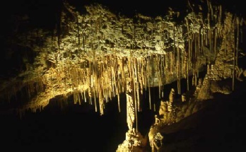
passage leads to a good sized chamber (typical of the Vercors with honey coloured
flowstone and a profusion of moonmilk) where by traversing around to the right (west)
is an anchor, which provides security for the final short descent to the back of the chamber.
In the floor of the chamber, separated by a ridge of rock are two shafts. The first
shaft, which takes everything that falls down the entrance shaft, is Stupot (the P39
on the 1958 survey), with the second shaft being the lateral shaft (P19 on survey).
Both shafts take water after heavy rain.
From the anchor at the back of the chamber there is a steep and slippery descent to two
anchors at the pitch head with a further anchor for a re-belay about 1 metre down. The
flat floored base of the shaft is a disappointing end to this superb shaft.
Scialet du Combeau
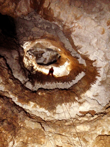
“Stupot” the big pitch in Scialet du Combeau
50m ->
100 ->
<- 130m
-80m _____

| News |
| SV Blog |
| Vercors Caving Log |
| Scialet du Combeau |
| SV Projects |
| Gouffre Berger |
| Grotte Roche |
| Scialet de la Jarjatte |
| Grotte Roche Gallery |
| Zone 1 |
| Zone 2 |
| Zone 3 |
| Zone 4 |
| Zone 5 |
| Zone 6 |
| Zone 7 |
| Zone 8 |
| Zone 9 |
| French Caving Terms |
| Via Corda |